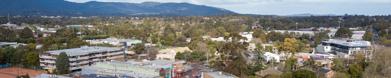
Croydon MAC Precincts
- retain and enhance the traditional retail role of Main Street.
- enhance the commercial role of the precinct by encouraging the development of office space in upper levels or in new development.
- ensure that new built form respects and celebrates the character of places with identified heritage significance along Main Street.
- facilitate increased night-time economic activity in the precinct through encouragement of the cinema, restaurants, and other complementary activities.
- retain a pedestrian friendly streetscape.
- have more people living in the centre through utilisation of new and existing shop top spaces.
- improve the function, amenity, safety and image of the intersection of Croydon Road, Railway Crescent, and Kent Avenue as an important entry to the Town Centre.
- support continued retail, commercial and mixed use development of the Croydon Central Shopping Centre.
- integrate the Croydon Central Shopping Centre into the centre, in terms of its mix of uses, built form, new station pedestrian access and site layout including access for pedestrians and cyclists.
- support the Civic Square Shopping Centre to maintain its convenience shopping role and provide a greater range of shops or services within the existing retail floor area.
- better integrate the Civic Square Shopping Centre with the community/civic precinct and Swinburne University.
- provide improved pedestrian links to Main Street.
- support additional development and activity between Main Street and the Civic Square Shopping Centre to activate these improved links.
- improve the function, amenity and safety of surface carparks while minimising their unwanted impacts.
- prioritise pedestrian access by limiting conflict between vehicle and pedestrians and limit vehicle access from Wicklow Avenue.
- limit overshadowing to the proposed path on south side of Wicklow Avenue.
- enable pedestrian access by incorporating a mid-block street arrangement for connection from Toorak Road to Kent Avenue
- support mixed use development of sites on Hewish Road opposite Croydon Park for higher density residential or commercial land use.
- facilitate opportunities for adaptive reuse of buildings particularly in relation to community uses with heritage significance.
- support mixed use development of sites along Mt Dandenong Rd and around its intersection with Main Street and Lusher Road for higher density residential or commercial land use.
- ensure new buildings along Mount Dandenong Road provide a positive entry to the Town Centre in terms of their mix of uses, overall form, design and materiality.
- facilitate the development of public institutions within the centre.
- upgrade Council facilities into a series of community hubs with co-located facilities.
- foster partnership arrangements between Swinburne University and the Council to share sporting, recreation and educational facilities.
- create convenient, safe and accessible pedestrian links between facilities within the precinct, Main Street and the train station interchange.
- ensure new development respects heritage assets in this precinct and promote opportunities for adaptive re-use of historic community buildings.
- transition the precinct into a high-quality urban services precinct.
- implement WSUD measures through the precinct to manage the impacts of flooding.
- improve the public realm of the precinct to make it an attractive place to do business.
- encourage development consistent with the preferred neighbourhood character.
- encourage established gardens with a substantial tree canopy cover.
- maintain setbacks around dwellings sufficient for adequate landscaping.
- ensure that development provides a positive interface with streets.
- ensure that new dwellings and extensions are sited and designed to respect the prevailing architectural character and landscape setting, including scale, materiality and detailing.
- protect and increase the tree canopy cover by requiring an adequate amount of permeable land for protecting and planting vegetation, including canopy trees.
- support the transition of properties adjacent to the Tarralla Creek corridor to a mixed-use precinct integrating positively with adjacent open spaces and providing ready access to the town centre.
- provide publicly accessible connections to public open space through or between larger sites.
- ensure that development provides a positive interface with streets and parklands.
- ensure that vehicle parking and access does not detract from the creek, streets and other public open space.
- ensure development provides sufficient space for generous landscaping and consistent tree canopy.
- transition properties to the east of Tarralla Creek to a high-quality urban services precinct.
- extend the ecology of the neighbouring Tarralla Creek and wetland, including the flora and fauna they support, optimising ecological corridors and opportunities for connecting to nature within the precinct.
- reduce potential for localised flooding (particularly east of Tarralla Creek).
- optimise tree canopy cover to provide shading, cooling and habitat.
- ensure that all dwellings, their settings and front fences make a positive contribution to the public domain and pedestrian environment.
- ensure that new dwellings and extensions are sited and designed to respect the preferred neighbourhood character and landscape setting, including building size, materiality and detailing.
- maintain established gardens and a continuous tree canopy cover.
- maintain generous setbacks around dwellings, and to ensure that front setbacks are not dominated by garages, carports or vehicular access.
- protect and increase the tree canopy cover by requiring an adequate amount of permeable land for protecting and planting vegetation.
- establish and maintain a clear sense of Croydon’s character in the open space network.
- ensure safe and convenient universal access to and through open spaces.
- support different activities within Croydon’s open space network for as wide a range of users as possible.
- ensure that open spaces are safe and amenable for all.
- improve the environmental performance and management of open spaces, including water management and habitat enhancement.
- ensure buildings provide positive interfaces with open spaces.
- establish positive edge and interface conditions around open spaces
Precinct 1: Main Street and Station Precinct
The Precinct
Main Street and Croydon Station form the core of the activity centre. The new Croydon Train Station and associated level crossing removal form a new sub-precinct of ‘Precinct 1’. Though similar in identity to ‘Precinct 1’, ‘Precinct 1a’ serves a unique, transit-oriented role that differs slightly to that of ‘Precinct 1’.
Precinct Objectives
For this Precinct, the Draft Structure Plan proposes to:
Precinct Development Framework
On the below map you will see Precinct and sub-precinct boundaries and other built form requirements for Precinct 1. Click on the map to enlarge it.

The proposed requirements have been drafted to encourage investment in properties in Main Street that support its economic and social vitality, while ensuring the protection of the amenity, vibrancy and safety of the streets and other public spaces.
These requirements are based upon and informed by the existing DDO controls which promote development built to the front boundary with a maximum height of four storeys and a two to three storey street interface with weather protection to footpaths.
You can also read more about the precincts, design and development requirements and guidelines.
Precinct 2: Commercial
The Precinct
Precinct 2 consists of two standalone shopping centres, Croydon Central Shopping Centre to the west of the railway station on the site of the former Croydon Market and Civic Square Shopping Centre next to the Fred Geale Oval.
Precinct Objectives
For this Precinct, the Draft Structure Plan proposes to:
Precinct Development Framework
On the below map you will see Precinct and sub-precinct boundaries and other built form requirements for Precinct 2. Click on the map to enlarge it.

The built form requirements have been drafted to support investment and further development of the centres so that they can continue to evolve and broaden their mix of complementary land uses.
Building heights, ground and upper level setbacks, and interface conditions are drafted to enable additional development while ensuring that it integrates well with its surrounds by protecting the human and environmental qualities of adjacent public spaces.
You can also read more about the precincts, design and development requirements and guidelines.
Precinct 3: Residential Growth
The Precinct
Precinct 3 sits at the southern end of Main Street and along eastern side of Lusher Road. It also includes areas north of Hewish Road and along the Railway Crescent. Dwellings in this precinct are mainly from the mid-late 20th century, detached, single storey, offset to one side of the lot with houses addressing the street. Subdivision of some lots, particularly on corner sites and facing the train corridor has occurred for dual occupancy and unit developments.
Precinct Objectives
For this Precinct, the Draft Structure Plan proposes to:
Precinct Development Framework
On the below map you will see Precinct and sub-precinct boundaries and other built form requirements for Precinct 3. Click on the map to enlarge it.

The precinct’s location, subdivision pattern, existing and adjacent land uses make it a clear candidate for more intensive residential uses and mixed use development. The built form requirements encourage more intensive development within the precinct to support the economic role of the centre while protecting the attractiveness, amenity, and safety of the adjacent streets, public spaces and parklands.
You can also read more about the precincts, design and development requirements and guidelines.
Precinct 4: Community and Education
The Precinct
Precinct 4 consists of three areas, one to the north-west, one that is central and one in the south-east. The north-western and south-eastern portions of the precinct are academic facilities consisting of Croydon Primary School and Swinburne TAFE.
Precinct Objectives
For this Precinct, the Draft Structure Plan proposes to:
Precinct Development Framework
On the below map you will see Precinct and sub-precinct boundaries and other built form requirements for Precinct 4. Click on the map to enlarge it.

The built form requirements support the redevelopment of community and public facilities within this centrally located precinct. They encourage the integration and co-location of activities for more efficient and sustainable use of public land and buildings. The requirements ensure buildings are designed to connect with and activate adjacent public spaces.
You can also read more about the precincts, design and development requirements and guidelines.
Precinct 5: Business
The Precinct
This precinct contains light industrial and commercial uses in the north-east corner of the activity centre and a similar area in the south east corner fronting Dorset Road. Many of the sites in this area are subdivided into multiple lots. Uses include numerous auto sales and repairs, bus depot, trade supplies, and electrical substation and some professional services.
Precinct Objectives
For this Precinct, the Draft Structure Plan proposes to:
Precinct Development Framework
On the below map you will see Precinct and sub-precinct boundaries and other built form requirements for Precinct 5. Click on the map to enlarge it.

This precinct includes a range of light industrial and commercial enterprises of different scales and intensities. The built form requirements are drafted to support this continued role whilst encouraging compatible, more intensive commercial development that reinforce the service and employment functions of the precinct. Best practice storm water mitigation is required to address the potential for flooding within the precinct.
You can also read more about the precincts, design and development requirements and guidelines.
Precinct 6: Residential Diversity
The Precinct
This precinct is located on the east side of the study area between Dorset Rd and the parklands and another much smaller area to the west. Primarily residential in nature many sites have been developed for generally low scale, multi-unit housing with more recent more intensive three to four storey apartments developments occurring.
Precinct Objectives
For this Precinct, the Draft Structure Plan proposes to:
Precinct Development Framework
On the below map you will see Precinct and sub-precinct boundaries and other built form requirements for Precinct 6. Click on the map to enlarge it.

The built form requirements for this precinct support its continued role by supporting further development of diverse housing types with well landscaped surrounds and protecting the amenity of adjacent residences and streets.
You can also read more about the precincts, design and development requirements and guidelines.
Precinct 7: Tarralla Creek
The Precinct
Precinct 7 consists of three areas of light industrial land located in the southern region of the Croydon MAC on either side of Tarralla Creek. Uses include warehousing and self storage, auto servicing and repair, light engineering services, electronics, and a substation. Buildings include large former industrial sheds and two churches.
Precinct Objectives
For this Precinct, the Draft Structure Plan proposes to:
Precinct Development Framework
On the below map you will see Precinct and sub-precinct boundaries and other built form requirements for Precinct 7. Click on the map to enlarge it.

The built form requirements support the precinct’s transition to an area of more intensive mixed-use development and activity consistent with its employment role and location within the Croydon Major Activity Centre. The requirements ensure that new developments establish a positive relationship to the Tarralla Creek, maximize landscaping opportunities, provide innovative responses to storm water impact mitigation and provision for access consistent with the Tarralla Creek Precinct Development Guidelines.
You can also read more about the precincts, design and development requirements and guidelines.
Precinct 8: Residential
The Precinct
Precinct 8 consists of two areas one at the northern end of the MAC south of Kitchener Road and the other to the east., between the rail line and Mt Dandenong Road. The precinct consists of larger residential lots with free standing houses, some subdivided for dual occupancy or multi-dwelling residential developments. Many sites have been redeveloped for dual occupancy or multi-dwelling residential developments.
Precinct Objectives
For this Precinct, the Draft Structure Plan proposes to:
Precinct Development Framework
On the below map you will see Precinct and sub-precinct boundaries and other built form requirements for Precinct 8. Click on the map to enlarge it.

The built form requirements maintain this precinct’s primary residential role while supporting further intensification of housing consistent with the preferred neighbourhood character. Retention and replacement of effective landscaping are important contributors to the maintenance of the area’s identity and amenity.
You can also read more about the precincts, design and development requirements and guidelines.
Precinct 9: Parkland
The Precinct
An area of approximately 35Ha of public open space comprising a broad range of active and passive recreation facilities. The precinct connects with Tarralla Creek south of the Fred Geale Oval and the shared path connection along Dandenong Ck to Carrum and eastward to Mt Evelyn and the Yarra Valley. The extensive area of parklands contain many established native and exotic trees which make a significant contribution to Croydon’s identity and character.
Precinct Objectives
For this Precinct, the Draft Structure Plan proposes to:
Precinct Development Framework
On the below map you will see Precinct and sub-precinct boundaries and other built form requirements for Precinct 9. Click on the map to enlarge it.

The requirements for this large precinct support the appropriate development or renewal of public and community facilities whilst protecting the accessibility, amenity, attractiveness and safety of the parklands and adjacent public spaces and streets.
You can also read more about the precincts, design and development requirements and guidelines.